


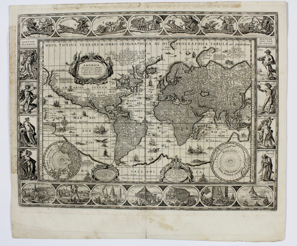
Incisione in rame (575 x 495 mm). Lieve segno di piega centrale. Testo latino al verso.
Celebre planisfero tratto dal “Theatrum orbis Terrarum” di Willem e Joan Blaeu.
“This classic single sheet world map on Mercator’s projection, brought out by Willem J. Blaeu in 1606, remained in active circulation for over fifty years. It is celebrated as one of the supreme examples of the mapmaker’s art… The map itself has been expertly reduced from Blaeu’s large worldmap of 1605, the engraver Josua van den Ende signing this single-sheet version.
The most striking characteristics of Blaeu’s map are the superb border decorations. Along the top are allegorical representations of the sun and moon and the five known planets Mercury, Venus, Mars, Jupiter and Saturn. Down the sides are, on the left, four panels illustrating the elements (Fire, Air, Water and Earth), and on the right, the four seasons. Along the bottom are seven vignettes showing the seven wonders of the world: the Hanging Gardens of Babylon, the Colossus over the harbour at Rhodes, the Pyramids (very quaintly depicted), the Mausoleum of Halicarnassus at Caria, the Temple of Diana (in Dutch baroque style), the Statue of Jupiter, and the conical lighthouse of Alexandria. Blaeu’s map was originally issued separately, and four states have been recorded.
As amended for state 4 the plate was first used in Blaeu’s Appendix and then in successive editions of his Atlas, starting in 1630 and continuing until 1658. There is printed text on the back of all editions from 1635 onwards.” (Shirley).
La carta è riconducibile al quarto stato, dove il nome di “Guilielmo Blaeuw” è aggiunto al titolo e non compare la data 1606 nel cartiglio.
Shirley, 255. Koeman, I, Bl2, p. 76.
€ 10.000,00